Tuesday, August 27, 2013

Blue Moon Canoe


Early in summer I proposed a canoe trip to our hiking club. Originally planned as a five day expedition I found few people were current in their paddling skills and that several novices were also keen to come along. The plan was adjusted to include a canoe and paddle intro session on a small lake and a shorter overnight trip on our stretch of the Yukon River.

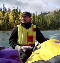
Peter Long photo
After a hearty breakfast at our friend David's cafe, we walked down to the river front with our gear where Scott and his staff set out canoes, paddles, life jackets and provided a helpful river safety briefing. We matched novices with experienced in each canoe and packed up. One after another we practiced our first eddy turns out into the river current.


The weather was sunny and warm. Our fleet of seven canoes and support boat meandered downriver, each canoe exploring nooks along the river bank or experimenting with paddle strokes trying to master the straight line. Others stopped for a shore lunch and hiked up Little Takhini Creek to see the beaver dams.

Peter Long Photo
At Egg Island, our overnight camping spot, we landed like geriatric Viking raiders and spread out over the island. We met two young families already on the island and they kindly moved things about to give us elbow room.

We set up a comfortable camp and over the afternoon hours a magnificent feast came together. We invited David and Doree Story, who live on the river near the island, over for dinner. The Storys have acted as stewarts of the island for the past twenty years and we were pleased to be able to honour their time and effort in keeping Egg Island such a pleasant place. The evening rollicked with colourful stories, jokes and high spirits.


Our island compatriots in their freighter canoe approaching The Duts'al Dhäl on the last leg of the trip.


Barb led us in Pilates exercises in the mornings to keep us from stiffening up while Peter tracked our journey on his GPS. I refrained from asking our average speed.


We stopped for lunch at Chamia and relaxed before ending the day at Policeman's Point just another two bends down the river.


The fleet approaches the upper end of Lake Laberge, a successful trial. Next year we'll tackle something more ambitious.

Thursday, August 22, 2013

Egg Island Retreat


Mid-summer and not a single multi-day trip on the river. I decided to just bail from the house and camp out on Egg Island for a few days. Not far downriver from our home, Egg Island, like most of the islands and sandbars in the Yukon River, is egg-shaped. However, unlike many of the other egg-shaped islands, Egg Island is in a good place to go camping. Thus it is celebrated by being named Egg Island.

Launching the boat at Takhini Crossing is sometimes a challenge. Loaded for a trip it is heavy and once in the river it wants to leave on the current. Launching solo requires finesse, back the truck up to the river's edge, tie off the boat to a tree, carefully lay out the painter so the truck doesn't run over it as the trailer is backed into the river. When the top of the trailer fenders are underwater - hopefully before the truck starts to float - jam the brakes on, watch the boat float off the trailer (or not, in which case start over) and once it is clear drive the truck forward pulling the trailer from under the boat. Quickly jump out of the truck, grab the painter and pull the boat fast to shore and then jump back into the truck and get out of the boat ramp. Finally return to the boat, pull on the life jacket and start the trip. Maybe the engine starts right away or maybe you decide to float downstream for the first few minutes.

Its a short run to Egg Island. Past the Adamson fish camp - only another week or so until the salmon arrive - and around the bend I pull up on the downstream end of the island and nuzzle into the bank close by the camp spot. Unload the boat, carry the drybag with tent, clothes and sleeping bag to the camp site, haul the kitchen box and cooler over to the picnic table in the grove of spruce and heave ropes and tarp under the table for later.

Previous visitors have left a sculpture. A short log stands upright under a tripod of driftwood sticks. On top of the log is an array of tiny pine cones looking like plump little dancers in a circle. On one side a long slim willow wand is anchored in the sand, the sharpened end points at one of the pine cones. Perhaps a boreal forest pine cone henge? Later during my stay I move the wand slightly walking by and magically the pine cones, each leaning on the next, begin to turn and spin on top of the log. Each cone follows its own erratic curve off the edge of the log. While it offered only one performance I am impressed by the maestro who set this up.


I settle in with a good book and watch the river. A loud buzz catches my ear. Before I can place the sound a brilliant red float plane roars past, not more than 5 metres above the water slightly more from the trees shielding me from its wingtip. I stop worrying about mosquitoes after that.

After dinner and a placid hour or so reading a book beside the river I head to bed. I'm awakened in the darkness by the sound of rain on the tent fly. Quickly, and naked, I'm out of the tent scrambling through the cold shower groping for the tarp under the picnic table, trying to keep my spread out gear dry. I'm now paying the price for a lazy evening. Back in bed I warm up and slumber into the morning. First job; set up the tarp, then coffee.

Later in the morning I float downriver to the sandbars around the corner where I find eight campers just rising to make breakfast. All are in their late twenties and come from eastern and central Canada. Well educated and already into their careers, cutbacks and economic malaise closed their future and they found each other in the break backing primary labour field, replanting shorn forests in the backwoods of British Columbia. They are recession refugees, economic victims with interrupted lives. One of them had previously lived in Dawson City and they all agreed to a float down the Yukon River after their work ended. Although the future was grey their spirits were high and they were taking advantage of the "found time" in their lives. I wished them the best and continued downriver towards Lake Laberge.


The Duts'al Dhäl (grey rock mountain in the Southern Tutchone language) is at the upper end of the lake. At the base of The Duts'al Dhäl is Chamia (where you set fish nets), the camping spot of Tachokaii - the creator figure of Yukon River Athapaskan culture - where he dreamed the first canoe into existence. A few years ago a First Nation carving group reproduced Tachokaii's work, working through the summer making a traditional cedar canoe. We live in a marvelously rich place. Forest fire smoke from further north wreathed through the valley towards the end of day.

About 5:30 I returned to Takhini Crossing and picked up my wife, just back from work. I opened a bottle of wine and we prepared a fine dinner of spinach salad and cassoulet. The evening passed delightfully with a colourful sunset and the coolness of dusk ushering us to the tent. Early in the morning, after a quick coffee, it was time to return to the car and send her off to work. Another relaxing day on the river for me.

Monday, May 27, 2013

Yukoners Take to The Air / Les Yukonnais prennent leur envole


On May 23, 2013 the Yukon Transportation Museum launched its new exhibit on the history of flying in the Yukon. The exhibity is the interpretive element of a major renovation of the museum's Bush Pilot meeting room. The original exhibit by Bob Cameron, from the late 1990s, has been masterfully transformed into a magnificent history book - Yukon Wings.

I took on the job of researching and writing the new exhibit. Yukoners Take to the Air / Les Yukonnais prennent leur envol was to develop local stories allowing visitors to find themselves in the exhibit. This approach meant a focus on the people who used planes and the consequences of air connections for Yukon communities. Canadian aviation history is often presented as a space conquering technology, an important theme considering the vastness of the country. The new exhibit however sets flying within the history of place, considering how Yukon people assessed and responded to the opportunities (and threats) afforded by aircraft.

William and the exhibit project started life together in the fall of 2012.


Janna, the Yukon Transportation Museum's Director of Collections & Research (and William's mum), organized the accessibility renovation of the museum's Bush Pilot Room, a major job. She also managed the exhibit development and installation. Janna stands next to the Gibson Girl emergency radio used by many northern bush pilots in the post-world war II period.

As long as America had the monopoly on the “bomb,” things seemed to be all right. But by 1953 the Communists not only had the bomb, but the bombers to bring devastation to North America.
Alas, not everything could fit in the exhibit. The privilege of a blog is that I get to include my favorite "not included on the voyage" element. These items were to help explain the origins of the DEW Line.


Among the fun things accomplished for the exhibit was the colourizing of several photos from the 1930s. I worked closely with the museum's aircraft restoration specialist who had flown this Fokker Super Universal (now at the Western Canada Aviation Museum) to make the photos convincing.


The exhibit consists of ten attractive panels designed by Patricia Halliday Graphic Design. Each 32" X 48" interpretive panel incorporates a combination of chronological and thematic content reflecting both the evolution of the organization of Yukon aviation and the services used by Yukon people and government.

In partnership with L'Association franco-yukonnaise the exhibit is bilingual, a Yukon first in a non-government cultural institution, and an element of the Association's co-operative approach to Francophone heritage presentation.


The museum is also working to make the building more accessible to seniors and those with disabilities. New dark flooring, high contrast edges, a wider door for wheelchairs and enhanced lighting as well as larger fonts and wheelchair height mounting of panels all contribute to better access to the museum and its stories.

The renovated Bush Pilot room had two openings: in the morning some 60 seniors arrived to see the exhibit (below) and in the evening another larger crowd gathered for the public launch. The YTM can be proud of their success in enhancing accessibility and in broadening their partnerships within the Yukon community.
 

And I had a great time working in this rich mix of stories, images and people.


Sunday, May 19, 2013

Traversing Yukon Landscapes - Yukon Arts Centre Summer Art Show

Camping at Burnt Point on the Yukon River, near Selwyn. 2012.
River camping has been an important part of our family's life. For years we made annual canoe and boat trips on the Yukon River or its tributaries. The highlight of everyday was finding a campsite and making it over into our home for the day. I have always been fascinated by the character of our interactions with place and the dynamics of how we, and many other river travelers, find home every night. As part of my research into this process in the summer of 2011 I invited Nicole Bauberger, a highly regarded Yukon artist of place and journeys, to paint the Yukon River between Lake Laberge and the town of Carmacks, some 300 kilometres down river.

This spring it was my turn to be invited to participate in the Yukon Art Centre's summer art show, Traversing Yukon Landscapes in collaboration with Nicole. I had co-operated with artists in  shows before but this time I was being extended an invitation to be an artist. For some time I struggled to understand how I could transform my historical questions and forms of communication into those of the fine arts. Nicole encouraged me to find my own way. Drawing from her fascination with the tarps I'd set up for our river trip I considered how I could incorporate them into the show. This was easy to do and helped me set up an approach that considered a river journey as a piece of art - the skills, materials and activities that allowed an engagement with place were also the tools for making a "home" every night.

Last fall I attended a community session on the Whitehorse shipyards. A number of seniors showed slides and remembered their youth. Interestingly these memories were not expressed as a series of events, things or places, rather it was the network of relationships with other people that had meaning. And these relationships made up place.

In my attempt to incorporate this idea into my art I considered how nature was an active partner in the creation of place or home. I queried our western predilection for structuring nature as a chrono-geographic matrix, in the process transforming the possibility of place into a platform for our human prowess and desires. How different from the memories of the seniors. How might nature see us?

 
And what do we see when we are outdoors. In addition to Nicole the artist, I've traveled the river with my family, land use planners, First Nation Elders, geologists, and studied the river in archives and map collections. But the river valley is not just a geography, rather it is a vibrant network of people, their stories, memories, knowledges and experiences bringing meaning to my own passage. How does one recognize the pulsing life of a place if we only consider the autopsy report of a cadaver?

Nicole's paintings were the centre piece of the installation. Evoking the journey, through both the eleven paintings completed on the trip and the annotations describing events, moods and observations, the exhibit reinforces the sense of a lively connection to place.


By Thursday afternoon the gallery was ready. Last minute trimming and placing of work, artists hustling off for a shower and fancy opening clothes, it was a calm and ordered space. The staff of the YAC Gallery had been enthusiastically helpful and supportive as we worked to "fit" our pieces into the gallery. For me it was a pleasant surprise to have such unbounded help in setting up Mahsi cho YAC.


I was pleased with my "campsite." Every item was real - a historian must work with facts after all. Equipment I decided I could spare for this season's boating, but each item marked with the signs of its presence in and contribution to making place. The campsite is just being set up, the visitors have to figure out how to make it home. The doors open and the visitors begin their exploration of the different traverses made by the artists.


Nicole and Joy, among the many people with whom I make home.

Sunday, May 12, 2013

Spring Walk Swans, Dams and Canoes

Winter ice disappears first where Marsh Lake empties into the Fifty Mile River. The arrival of migrating swans and ducks on these open waters are the among the first signs of a Yukon spring.

Our group chose this place for our early May hike. We start pas the Marsh Lake Dam. First built in the early 1920s, the dam held back water through the winter. In May the water was released to raise the water level for the river boats heading north and to help breakup and flush the ice out of Lake Laberge. Now the rebuilt dam, on the same site, serves the hydro electric plant at Whitehorse by holding back water during the summer and releasing it through the winter to maintain power production during the peak demands of winter. I am currently researching the environmental consequences of the dam and its changing functions.

 From the high bank of the river we look down on snoozing swans. On our return later in the day they were in the water, feeding, and pondering the possibilities of heading further north.

Other birds have also returned. A pair of nesting eagles took turns on the nest but also had a couple of brief episodes of aerial cavorting together during the shift change.

From the trail we had a splendid view of the east side of Grey Mountain. The early clearing of the river also attracts paddlers who are keen to begin training for the annual Yukon River Quest, the epic 715 km canoe race from Whitehorse to Dawson in late June.


Our turn around point was a lovely sunny riverside campsite. We sat on the dried and warm ground, a change from the winter for sure, and day dreamed an evening hike and a supper at this idyllic location.


Saturday, May 11, 2013

Aoraki / Mount Cook


Another view of Mount Cook station emphasizing its proximity to Aoraki. One day we visited the station to walk the Alps to Ocean bike trail, two warm days later with a strong up lake wind we found the previously high and dry flat covered with a foot of water from the rising river. Winter here must be traumatic.
The road to Aoraki runs up the west side of the lake. Mt Cook has been a tourist destination since the 1880s, originally for the mountain climbing. It quickly became a mountain retreat with the construction of the original Hermitage in 1884 and regular rebuilds expanding the "Swiss-style alpine village" of Mount Cook.
The Village of Mount Cook


A wonderful source for a highly visual history of New Zealand tourism is Selling the Dream: The Art of Early New Zealand Tourism. The Hermitage features discretely in almost all of the promotional posters for the resort. These, dating from the early 1930s, were produced by the New Zealand Department of Travel Services which operated the Hermitage for much of the twentieth century.


Leaving the coastal plain of farms and sheep stations and rising into the high country of Aoraki is an entry into a dramatic and and challenging environment. At the same time looking out over the active ice fields and the human induced changes here - land clearing, dam building, forestry plantations and introduced deer and other animals - gives some insights of the processes of the human desire to remake new places into new homelands.