Sunday, January 24, 2010

Ngāi Tahu on the Waitaki River


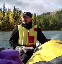
Waitaki River hydro-electric powerplant, 1922.

This morning Dr. Garth Cant, Professor of Geography at Univ. of Canterbury, invited me to an environmental assessment hearing. The walk had been cool in the morning air. Held in the Boatman's restaurant at Christchurch Town Hall, the room's warmth surprised me. Packed with submitters, applicants, the assessment panel as well as a large public audience, it was clear this was a controversial project. The proposal under review was for a large-scale change to regional farming practices. It proposed the transformation of a number of large farms on the upper watershed of the Waitaki River from pasture to a dairy operation with irrigated fields and heavy effluent flows. I attended the initial two hours of two days of presentations from the
Te Rūnanga o Ngāi Tahu (Maori Iwi covering the bottom two-thirds of the South Island of New Zealand) of the area.

The first to speak was David Higgins. He spoke steadily and with colourful detail throughout for over an hour, providing an introduction to the rūnanga (the governing council of a Māori iwi) authority, interests and values in the area. He also emphasized how the different iwi making up Te Rūnanga o Ngāi Tahu worked together, but also how they were not only a part of, but also active partners in, contemporary New Zealand society. His presentation intertwined these themes to set the stage for the following speakers of the Ngāi Tahu, Elders with their traditional knowledge and experience and and then researchers and land managers with their detailed reports on the values to be guarded, who would follow in the coming days.

David opened his talk establishing his personal authority, detailing why what he was about to say mattered and was true. He listed his lineage, carefully proceeding back in time from one generation to the next, describing who these ancestors were, what they had accomplished and affirming his intention, and responsibility, to honour their lives through his. He then recalled his own experiences within the traditional territory, his introduction to catching eels, picking rosehips as a child for cash at the store, and his stays at the old camps. We listened as he mapped his life path, the growing responsibilities he inherited from his Elders, that he accepted from his community, and his achievements, not as personal triumphs, but as proof of his understanding of what was important to his community. And then he proceeded to do the same for each of the iwi members who would be presenting over the next couple of days. Their ancestors, abilities, and powers were all described in only slightly less detail than his own.


Waitaki River dam, 1922.

Having introduced the submission team members, David outlined the Te Rūnanga o Ngāi Tahu interests and cultural values associated with the upper Waitaki River valley. He described the importance of the natural river flows, the recovery and maintenance of the traditional Maori cultural landscape and eco-system, the remediation of the different deltas, rich sources of traditional foods, and the interests of the iwi in being able to continue the use of these areas for their life ways. This broad sweep was refined as he described some two and a half centuries of a reflexive and consistent Maori land and resource management practise. He started with traditional stories speaking to the use of the land for subsistence, the seasonally adapted annual round, the harvesting of eels and other animals at the peak of their fat cycle to make them easier to preserve, the knowledge and skills to construct reed rafts as part of these harvesting activities and finished by telling how, in partnership with non-Maori partners, these different activities were being passed on to the youth today. Having thus cemented the significance and power of the information to follow in the audience's mind, he moved on to tell us who the people of the Te Rūnanga o Ngāi Tahu were.

He began to unfold a history that began about 1100 years ago with the first arrival of the Ngāi Tahu in New Zealand. He reminded the listeners of each of the major wars and diplomatic events as the Ngāi Tahu gained territory on the South Island through conquest and peace through marriage. By the late 17th century the Te Rūnanga o Arowhenua, Te Rūnanga o Waihao and the Te Rūnanga o Moeraki (the three iwi directly affected by the proposal) had settled along the Waitaki River and retained their connection to it today. David highlighted the continuity of people and their interests over the past 300 years, both through oral tradition and by reference to the treaty lists and census taken since the mid-19th century. While the sale of their territory to the Crown in the 1840s was recognized, David stressed the continuing disagreement over what the boundaries of the sale had included - a fact recognized by the New Zealand government through an apology and compensation to the Ngāi Tahu in 1991. (More on this available at http://www.waitangi-tribunal.govt.nz/reports/viewchapter.asp?reportID=D5D84302-EB22-4A52-BE78-16AF39F71D91&chapter=58) The boundaries of community were clearly and consistently defined, they were a real people. The governments they created and the officials designated by them were based on history, on tradition and in law. What they will say at this meeting carries the weight of the present population, and of their ancestors, who know and value this place. It is significant and carries power.


Waitaki River remnant, 2010.

David concluded his introduction with a detailed account of the traditional annual subsistence round, and its contemporary equivalent, especially noting how efforts were being made to engage youth - the Ngāi Tahu future - in their homeland and their heritage. He continued by reviewing the signs upon the land that spoke to the presence and practices of the Ngāi Tahu - the settlements and camps, many now submerged by hydro-electric developments in the 1970s and 80s, the resource harvesting sites, both ancient and contemporary, and the trails connecting all of these together. Each trail was followed in story and purpose, outlining how the people worked together and shared a good life in the region, a way of life they intended to continue into the future.

Having spoken for over ninety minutes, David introduced Elder Paul Horgan who would, after a coffee break, begin to tell the review panel about the Ngāi Tahu and their presence on the upper Waitaki River.

Thursday, January 21, 2010

Whanganui River Trip - Tricky Rapids


We have a tradition of canoe trips as the family holiday. For many years we 've spent our summers paddling different stretches of the Yukon's Rivers, and now we're ready to do the same in New Zealand. We arranged a trip through a local outfitter and picked up canoe, paddles, kitchen and barrels in Taumarunui. Erin and Joy had planned our meals - couscous, stir frys and pasta - and expertly packed our six barrels with clothing and food. By mid-morning we launched.

The Whanganui River is one of the few "navigable" rivers of any length, ~230 km, in New Zealand. Our trip would cover the upper 145 km, in the course of which we would be challenged by 196 rapids and other river obstructions. But in the late 1800s, steamers began travelling up the river and blasting of rocks and building of weirs remade the river to ease their passage. Still it must have been a challenge pushing a boat up this river.


Our first day included 67 rapids so the adrenaline level was high as we approached the first twisting bend of the river. We stopped, walked the shingle bar dividing the river into a back slough of willows and the frothing whiteness of stones that was supposed to be the main channel. Patrick and Linda, a German couple, decided to line down through the willows so Erin, as lead Canadian, made us run the froth. We paddled across the channel and turned into the foam. Remarkably as we entered the rapid, the river seemed to slow and guiding the canoe through the rocks came easily. A whoop as we passed the last boulder and we were through. With all the practice, confidence built quickly (not so sure about our rusty skills though). Soon we just eyeballed the fall as we approached and went for it. The sunshine and spray made for an exhilarating first day. Our outfitter's launch remark, "It's a pink, not white, knuckle experience," seemed true enough.


We camped at Poukaria, shady and cool. Over a convivial dinner we got to know our travelling companions. In addition to Patrick and Linda, there was young British couple, Amy and Alex, also on their first canoe trip. For the next three days these were the only people we would see on the river. We had passsed through pasture lands early in the day but by evening, hills were rising around us and there were no signs of human habitation. Later we learned Poukoria was one of between twenty to thirty Kianga (Maori camps) on that first stretch of water. Hardly an empty land.


A 1921 river guide nostalgically noted;
To-day the valley land is all taken up, and for some years thousands of sheep have occupied the ancient battlefield and hunting grounds of the Maori. When the writer first went up the river over 30 years ago all these old Kainga were picturesque scenes of Native activity, and the shrill chorus of the Haere-mai welcome as the stranger's canoe came near can never be forgotten. But alas! gone from the upper river is all that pertains to the old-time Maori; gone is the grand fleet of canoes that carried their complement of 50 to 100 warriors, when warlike occasions demanded, or on peaceful visitations, food gathering expeditions. No more does the old-time Native craftsman ply his peaceful arts in river or forest, hewing out his well-designed canoe or carving his wonderfully grotesque figures. He has gone and with him is going the lordly forest primeval, with its dark shadows, its ever changing lights and shades, its noble ratas towering above every bluff and covering the lofty hill sides with sheets of flaming red; and with the trees the birds. But enough - who would hinder these marks of progress?

Friday, January 15, 2010

Whanganui River Trip - Heading North 2


Erin has to renew her passport and, at the same time, I get to meet the Canadian High Commission's education officer to chat about academic exchanges between Canada and New Zealand. Afterwards I get to sit with Erin over coffee and hear what she's learning about place and meaning making, the Canadians teaching at Canterbury Uni and New Zealand life so far. It is a treat to experience her enthusiasm.

Driving along the coast highway we reach the mouth of the Whanagnui and dine on vaguely Italian food in a shady bower beside the river. The Whanganui is the longest navigable river in New Zealand and its history has much in common with the upper Yukon River we know so well at home. Maori exploration, tales of founding and intermarriages securing peace and security in its watershed. Newcomer pioneers similarly used the river as an avenue for settlement and steam boats, one reconstructed and now offering short tourist runs on the lower reaches goes past us while we finish our lunch.

In the evening we are camped along the upper reaches of the river at Taumarunui (Toe-ma-ra-newy) The water is low and shines green from the surrounding vegetation. It has a faint smell of musk, possibly rising from the lush, highly varied vegetation along its banks. Tomorrow morning we will immerse ourselves in the smell, taste and history of this river.


Whanganui River Trip - Heading North 1


Early morning to go and catch the train, all packed up the night before. Erin packed a breakfast of Stephen`s fresh berry muffins, cheese and fruit. Then strong coffee from the train cafe car and we settle back to watch the Canterbury Plain out the window. We are heading north from Christchurch to Wellington on our way to the headwaters of the Whanganui River (Fan-ga-newy) for a five day canoe trip.

There are only three passenger train services left in New Zealand. Each travels only once a day. Our train, in the middle of the summer holidays, is almost completely full. Passenger rail service effectively ended with the “New” Labour government rationalization of the economy in the early 1990s. The national rail service was sold off to a private company which mined it our for cash and then sold back the now eviscerated service to the New Zealand government. And now there are only three passenger rail services left in the country.

The train starts across the Canterbury Plain, open ground with copses of large trees, an almost English country landscape of small farms with the village church spires rising above the trees, horses trotting in pastures stretching away from the railway tracks. It is a far cry from the heavily forested landscape first longingly witnessed by botantist Joseph Banks from the deck of Cap't James Cook's Endeavour some 240 years ago. The New Zealand 50 cent piece commemorates this passage with a view of the Endeavour sailing along the southwest coast of the North Island with Mount Taranaki towering in the background.

In the evening Erin leads us on a walk along the harbour front of Wellington. We pass behind Te Papa “Our Place”, the national museum, and a large propeller from HMNZS Wellington, a Cold War frigate, in a terrific wind. My pant legs crack and snap, it is possible to lean on the wind as it cuts across the harbour, the last time it saw land was in Chile. At the windiest point on the waterfront we sample the Wellington Writers' Walk:
Their heads bent, their legs just touching, they stride like one eager person through the town, down the asphalt zigzag where the fennel grows wild, and on to the esplanade. It is dusky – just getting dusky. The wind is so strong that they have to fight their way through it, rocking like two old drunkards.
- Katherine Mansfield, "The Wind Blows"
For more on the Writers' Walk see Justine Clark, Writing by Types, Artichoke magazine, Australia / April 2003 at: http://www.catherinegriffiths.co.nz/00%204.ART1.html. And check out Mansfield at Wikipedia for insights into a colourful member of the neo-pagans. She never did like New Zealand, except as nostalgia.

Saturday, January 2, 2010

Crossing the Pacific


The overnight flight from Vancouver to Sydney, Australia may be the longest flight Air Canada offers. In compensation for our somewhat bumpy ride however, the view out the window offered a stunning extended sunrise. The plane flew amidst the high elevations of a badlands skyscape of towering thunderheads, each eroded into weird shapes by the wind. Beyond them was an evil crimson sky that flared and glowered amongst the clouds as we passed through the canyons and over the ridges around us.

Christchurch, New Zealand sits on the Canterbury Plain, a flat, once largely wetland slope gently meeting the Pacific Ocean as a long line of artfully disconnected sandy beaches. We chatted with the curator of the City's museum one afternoon and he informed us that if the city idea had been passed through a contemporary environmental assessment process, it would have been denied. Even so it is a beautiful place, at least in January.

We live close by the River Avon, a tree shaded swath of green winding into the city centre and lined with mostly small cottage type housing. Our backyard is a small jungle of both oversized familiar plants - mint and rosemary - and large unfamiliar ones. It also includes the required bbq.